There are 2 main ingredients needed when it comes to snow. Firstly, the upper air temperatures in the troposphere need to be around -5 or below at 850hpa level. Particularly important when the air is moist i.e. tracks over the sea as opposed to being sourced from the continent when upper air temps can be a bit higher.
The second is the thickness lines you mentioned, these need to be as close to 528 dam or below. It is 546 or above forget it! 510 is the holy grail for the UK.
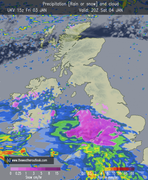
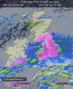
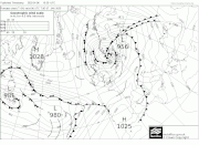
So, the fax shows a warm front heading north across the line north Wales eastwards , the precipitation can be up to 100 miles ahead of the front, this will be all snow. As the warm front clears, warm air is introduced at 850 hpa level rising above the residual cold air, so although the temperature on the ground will still be very cold, the higher air temperatures rise around cloud level, this is where you get freezing rain as the clouds produce rain which freezes as it hits ground level. As the warm front clears the warmer air replaces the cold surface air and it’s just plain rain.
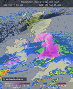
The cold front introduces colder air and pushes the warmer uppers away, however, if the 2 ingredients mentioned above are not in place it will still be rain.
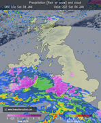
Your definition of occluded front is correct, however as neither of the 2 ingredients mentioned at the start are in place it will just be rain on Monday.
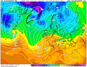
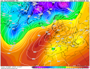
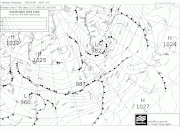
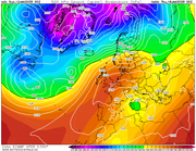
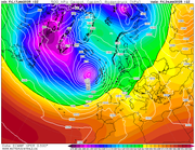
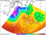
You can see from this 850hpa chart for mid-day Sunday how the warm uppers follow the warm front even though ground temperatures will still be very cold in northern areas.
Bit rushed, you are correct, I'm in work